 |
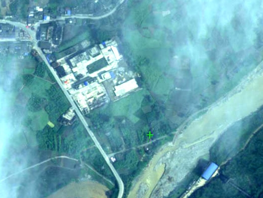
| The comprehensive aerial remote sensing image over Ya’an taken by Chinese Navy’s “commendation” aircraft. |
Second, military aviation technology
1. Remote sensing probe
Military remote sensing aircraft, unmanned aerial vehicles can access high-resolution color images to provide a reliable basis for the rescue decision-making.
A remote sensing aircraft of China’s Navy performed aerial remote sensing tasks over Ya'an city and provided accurate data for disaster relief after the 7.0-magnitude earthquake hit Lushan County of Ya'an City in southwest China's Sichuan Province at 8:02 a.m. on April 20, 2013.
A research report has been developed after experts processed and interpreted the remote sensing data. The report has been submitted to the related departments in batches, and it will provide timely and accurate data for the search and rescue.


 Photo story: 'Grassroots philanthropist' donates foods to quake zone


![]()
