


Drone images show Myanmar earthquake aftermath
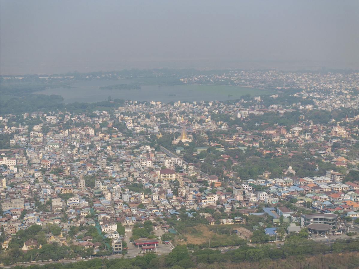
An aerial drone photo taken on March 31, 2025 shows the city view after a 7.9-magnitude earthquake in Mandalay, Myanmar. (Photo/Xinhua)

An aerial drone photo taken on March 31, 2025 shows the city view after a 7.9-magnitude earthquake in Mandalay, Myanmar. (Photo/Xinhua)

An aerial drone photo taken on March 31, 2025 shows the city view after a 7.9-magnitude earthquake in Mandalay, Myanmar. (Photo/Xinhua)

An aerial drone photo taken on March 31, 2025 shows the city view after a 7.9-magnitude earthquake in Mandalay, Myanmar. (Photo/Xinhua)

An aerial drone photo taken on March 31, 2025 shows the city view after a 7.9-magnitude earthquake in Mandalay, Myanmar. (Photo/Xinhua)

An aerial drone photo taken on March 31, 2025 shows the city view after a 7.9-magnitude earthquake in Mandalay, Myanmar. (Photo/Xinhua)

An aerial drone photo taken on March 31, 2025 shows the city view after a 7.9-magnitude earthquake in Mandalay, Myanmar. (Photo/Xinhua)
Photos


Related Stories
- Chinese rescuers pull out pregnant survivor in quake-hit Myanmar city Mandalay
- Another Chinese rescue team arrives in Myanmar's quake-hit Mandalay city
- Chinese Red Cross International Emergency Response Team arrives in Myanmar's Mandalay
- Chinese rescuers save 4 lives in 7 hours in quake-stricken Myanmar
- China's border province sends more relief supplies to quake-hit Myanmar
Copyright © 2025 People's Daily Online. All Rights Reserved.
