
 |
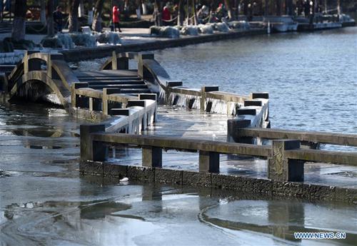
| Photo taken on Jan. 25, 2016 shows the icicles on a bridge at the West Lake scenic spot in Hangzhou, capital of east China's Zhejiang Province. (Xinhua/Han Chuanhao) |
The strongest cold wave to strike China for 20 years ended on Monday morning after breaking records at 82 meteorological stations across China, chief forecaster He Fuli of the National Meteorological Center told China News Service.
The National Meteorological Center has lifted the cold wave’s orange alert. Although the southern region of China is still experiencing cold weather, some areas are gradually warming up.
According to meteorological observation at 7 a.m. Monday, the temperature of most regions from northern to southern China was below 0 degrees Celsius. As of 2 p.m., the temperature rebounded to 6 to 15 degrees Celsius in many southern areas.
He believes the average temperature drop is not severe for an extreme weather event. But the low temperature and snowfall caused by the wave in such short time do make it the strongest cold front for 20 years.
“Many meteorological stations are not even a hundred years old,” He refuted the opinion of defining the wave as the “once-in-a-century”.
The cold wave broke the lowest temperature recorded in 82 meteorological stations since their establishment (around 60 years), including the ones in Zhejiang and Jiangxi provinces, said He.
As the wave ends, the temperature in those areas will increase by 6 to 8 degrees Celsius, approaching the normal level, he added.
“Before the Spring Festival, there will be a weak cold front that affects the middle and lower reaches of Yangtze River,” He forecasts. The cold air is expected to arrive in China between late January and early February.
 A foreign girl explains what China should be proud of
 Chinese navy's air-cushioned landing craft in pictures
 Chinese pole dancing master opens class in Tianjin
 PLA holds joint air-ground military drill
 Charming female soldiers on Xisha Islands
 Beautiful skiers wear shorts in snow
 Getting close to the crew on China's aircraft carrier
 Chinese stewardess celebrate test flight at Nansha Islands
 Pentagonal Mart becomes the largest vacant building in Shanghai
 Top 20 hottest women in the world in 2014
 Top 10 hardest languages to learn
 10 Chinese female stars with most beautiful faces
 China’s Top 10 Unique Bridges, Highways and Roads
 Online crusade
 Choi Sung-kook the king of stickers
 PLA art troupes shrink under military restructuring
 Bridging the gap between cultures over the holiday
Day|Week